

Our Flying Areas
The DIP Drone Hub provides access to a varied selection of flying and testing areas across Dorset Innovation Park. These include large open grassed areas, compact development plots, mixed terrain, heathland and woodland. Areas may be requested individually or in combination, subject to availability and operational review.
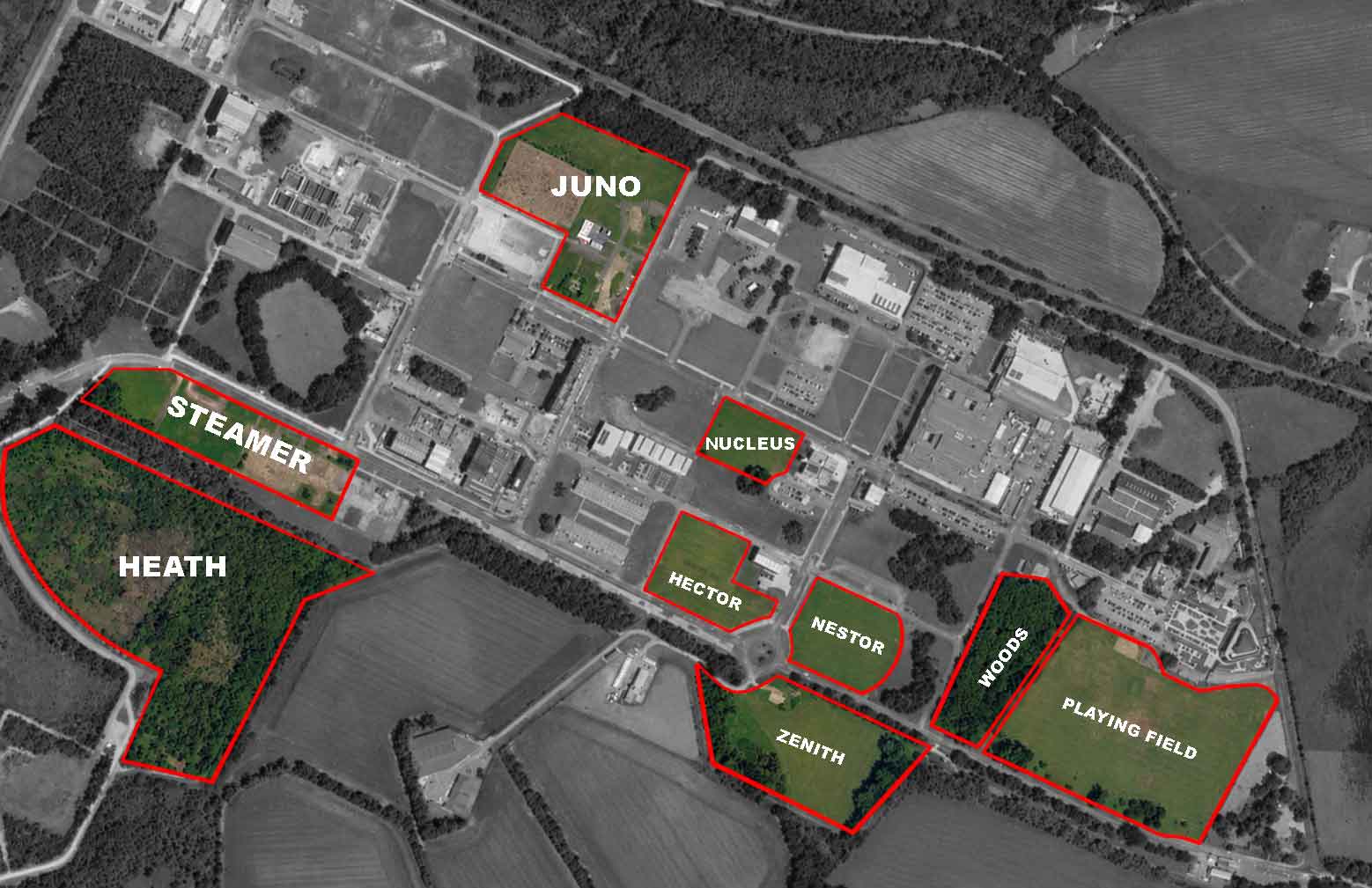
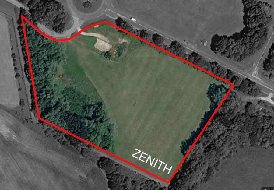
Zenith
Zenith is approximately 3.5 acres and offers a smaller, more enclosed flying environment. The area is lined by trees, giving it a clearly defined character that can suit controlled demonstrations, training and trials that do not require a larger operating space.
After entering Dorset Innovation Park through the security gate, continue for approximately 600 yards. At the roundabout, take the left exit; Zenith is situated on the left hand side.
A hardstanding area is available alongside the grassed flying space, providing a practical location for aircraft preparation, equipment setup and supporting vehicles.
Potential uses
- Remote pilot training
- Aircraft demonstrations
- Prototype evaluation
- Payload and sensor testing
- Customer familiarisation
- Short repeatable test flights
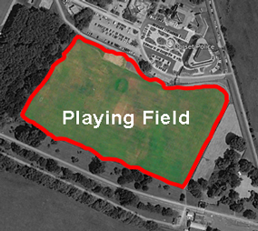
The Playing Field
At approximately 8.5 acres, the Playing Field is one of the larger and more open areas. It is a natural choice for activities requiring additional ground space, longer flight lines, multiple operating positions or greater separation between the flight team and supporting equipment.
The central area is predominantly open and grassed, with established trees along the western side providing a clear visual boundary. The possible effect of the trees on local wind and turbulence should be considered during flight planning and the day of flight assessment.
The Playing Field is located opposite Dorset Police Headquarters.
Potential uses
- Remote pilot training
- Aircraft demonstrations
- Payload and sensor trials
- Flight performance testing
- Emergency services exercises
- Structured test programmes
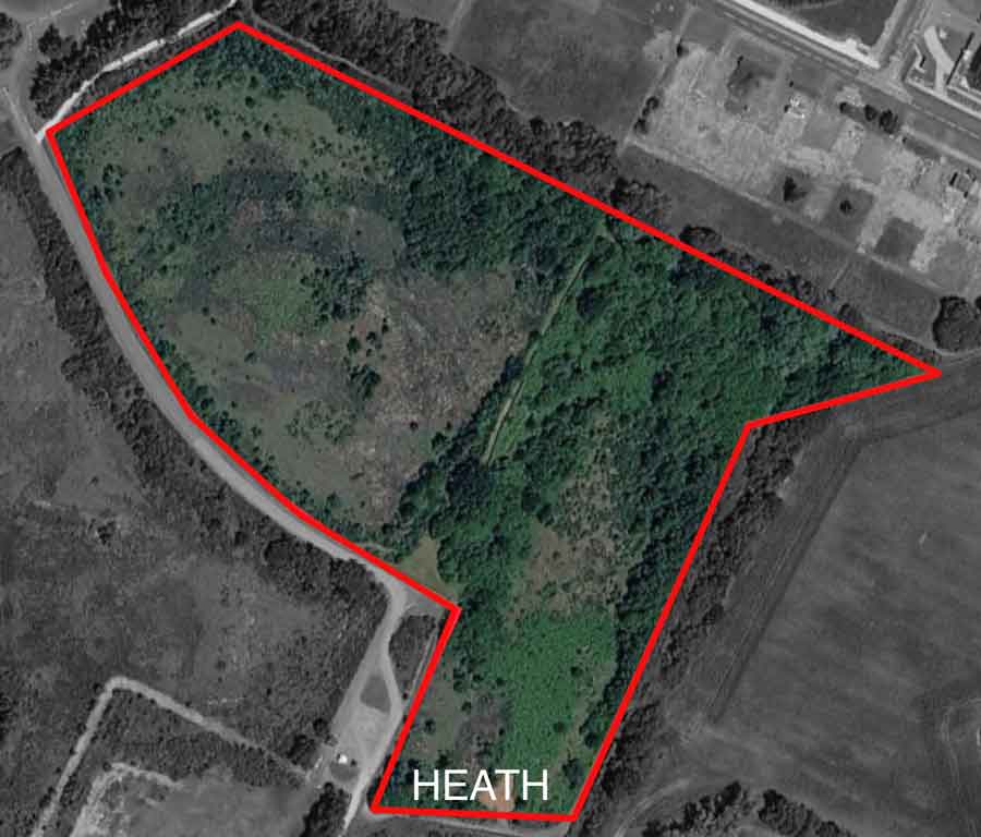
Heath
At approximately 18 acres, Heath is the largest of the available plots. Its combination of open ground, heathland, scrub, woodland edges and established tracks creates a varied environment for activities that benefit from greater space and changing terrain.
The mixed landscape may be particularly useful for search scenarios, environmental monitoring, thermal surveys and autonomous navigation development. Proposed activity will be reviewed against ground conditions, environmental sensitivities and other nearby operations.
Potential uses
- Search and rescue exercises
- Environmental surveys
- Thermal imaging trials
- Mapping and photogrammetry
- Autonomous navigation development
- Ground robotics testing
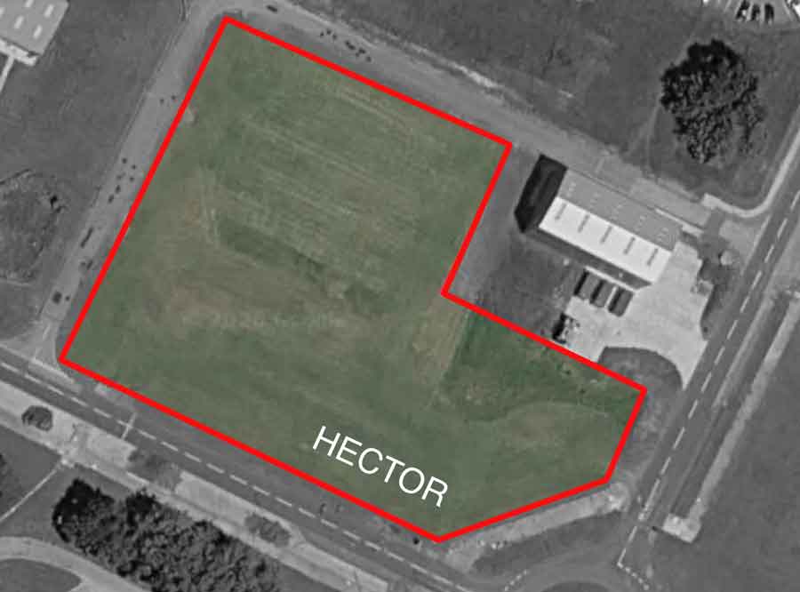
Hector
Hector is a compact plot of approximately 2.33 acres positioned close to buildings and internal roads. This gives the area a more developed character than the larger open fields and may support controlled work involving structures, boundaries and restricted operating space.
Its proximity to Zenith and Nestor means use of Hector must be coordinated with bookings taking place in those neighbouring areas.
Hector is located behind the BattleLab hangar and in front of the Quadrant units.
Potential uses
- Building inspection exercises
- Precision hover trials
- Obstacle awareness testing
- Small aircraft demonstrations
- Sensor evaluation
- Operator familiarisation
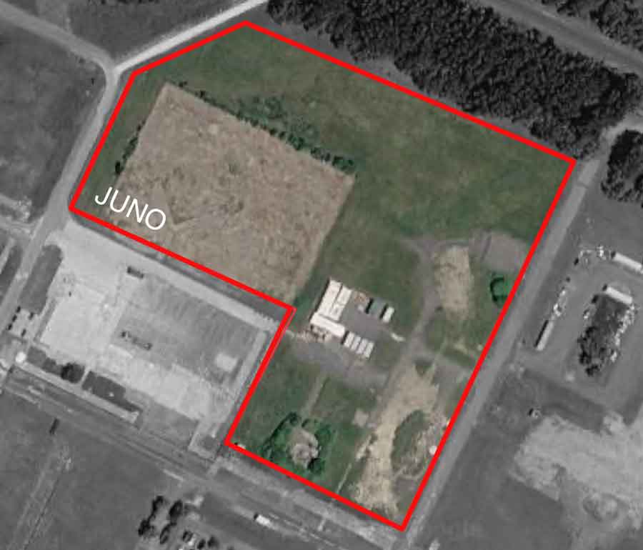
Juno
Juno covers approximately 6.43 acres and combines grassed space, disturbed ground, hard surfaces and small structures. The variation across the plot offers a useful development environment for projects involving terrain changes or more than one surface type.
The final suitability of the area will depend on the proposed flight profile, aircraft and condition of the plot at the time of use.
Potential uses
- Mapping and photogrammetry
- Construction site exercises
- Terrain assessment
- Structure inspection
- Payload and sensor trials
- Ground robotics testing
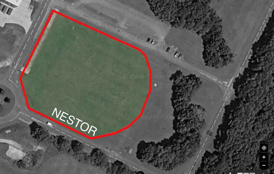
Nestor
Nestor is an open grassed plot of approximately 2.63 acres. Its compact size makes it suitable for controlled, short range activity that does not require the operating footprint of the Playing Field or Heath.
Nestor sits close to both Zenith and Hector, so bookings must be deconflicted with activity taking place in either neighbouring area.
Nestor is located in front of the BattleLab hangar and adjacent to Zenith.
Potential uses
- Precision hover work
- Aircraft handling exercises
- Basic remote pilot training
- Small platform trials
- Customer familiarisation
- Repeatable test flights
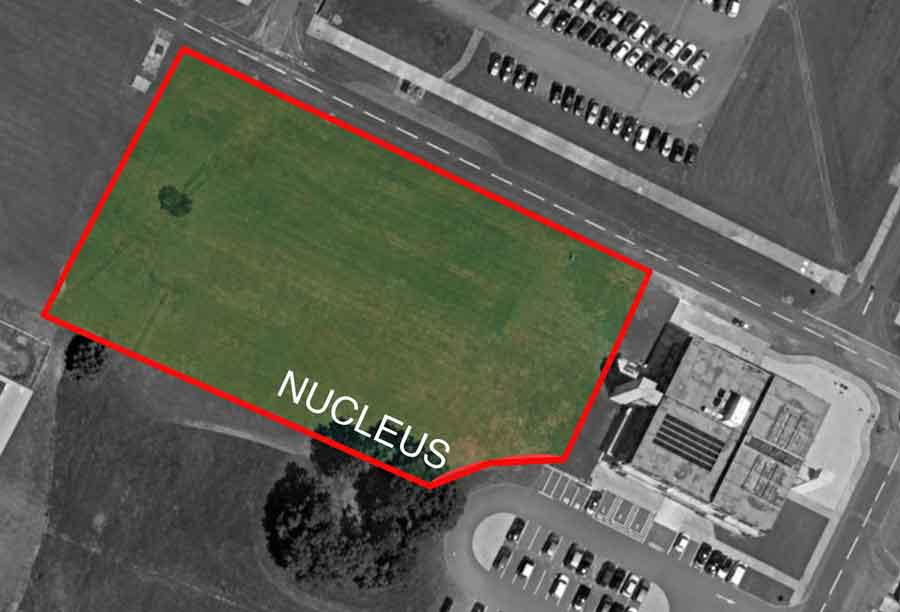
Nucleus
At approximately 1.47 acres, Nucleus is the smallest of the listed plots. It provides an accessible open grassed space near roads, parking and buildings, making it useful for tightly controlled activity and projects requiring convenient access to supporting equipment.
The limited footprint means aircraft type, containment and intended flight profile will be important considerations during review.
Nucleus is located behind the BattleLab.
Potential uses
- Precision hover testing
- Sensor calibration
- Small aircraft demonstrations
- Static equipment trials
- Operator familiarisation
- Short duration development work
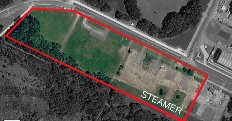
Steamer
Steamer is a long, narrow parcel of approximately 5.73 acres and around 350 metres in length. It combines grass, tracks, hardstanding and a woodland edge, providing a distinctive linear environment for corridor style testing and development.
Heath is located nearby, so bookings across the two plots may require additional separation or coordinated use.
Potential uses
- Linear infrastructure inspection
- Corridor mapping
- Route planning trials
- Tracking and autonomy testing
- Ground robotics development
- Sensor evaluation
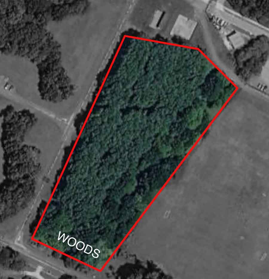
Woods
Woods covers approximately 3.44 acres and provides a specialist environment that is substantially different from the open flying plots. Trees, restricted sight lines and overhead cover may support carefully planned trials involving navigation, sensing and communications in a woodland setting.
The plot adjoins the Playing Field, so use of either area must be considered when the neighbouring plot is occupied. Woodland operations will require specific assessment before approval.
Potential uses
- Under canopy trials
- Search exercises
- Thermal imaging evaluation
- Obstacle awareness testing
- Communications trials
- Ground robotics development
Access and arrival
All flying and testing areas are located within the secure Dorset Innovation Park site. Visits must be booked in advance, and the full names of expected attendees may be supplied to site security before arrival. Final directions and the agreed meeting point will be provided with the approved booking.
All visitors must show valid identification when requested at the security gate.
Choosing an area
The most appropriate area will depend on the aircraft, planned flight profile, number of participants, supporting equipment, terrain requirements and purpose of the session. One or more areas may be requested within the same booking.
Vaspba will review the proposed activity and confirm whether the requested area is suitable.
Deconfliction and neighbouring areas
Some plots are close enough that separate operators may not be able to use them at the same time. Availability of neighbouring areas is therefore considered when every booking is reviewed.
Zenith, Nestor and Hector form one neighbouring group; Woods adjoins the Playing Field; and Heath is close to Steamer. A booking in one of these groups may therefore restrict availability across the associated plots.
Where a project requires more than one neighbouring plot, those areas can be included within a single booking request. Coordinated or simultaneous operations remain subject to specific operational review and approval.
Booking and operational approval
Availability of an area does not itself constitute permission to fly. Every request remains subject to review of the proposed activity, aircraft, personnel, insurance, operating permissions, RAMS and current site conditions.
Booking multiple areas reserves each selected space but does not automatically approve simultaneous aircraft operations. Any concurrent flying or coordinated use of neighbouring plots will be considered as part of the operational review.